Expedition yachting is becoming ever more popular with superyacht owners and charter guests with a heightened sense of adventure. In the Global Order Book, it is listed that almost 100 explorer yachts are being or are set to be built.
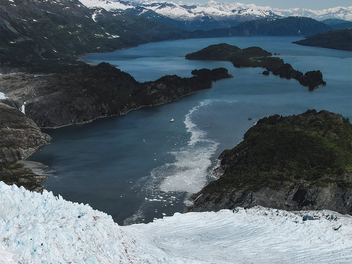
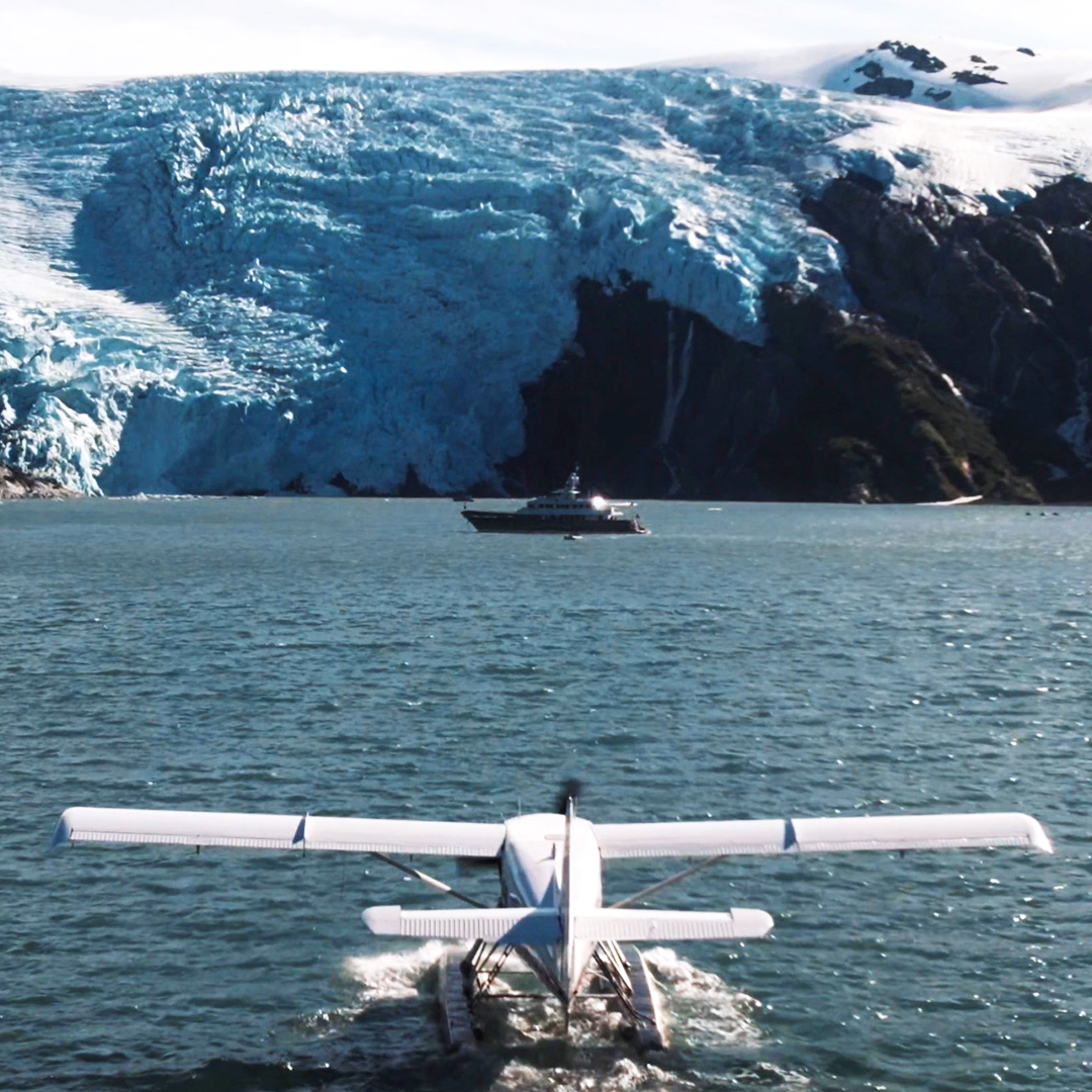
The furthest reaches of our oceans are being explored more often with boats choosing to visit the polar regions of the Arctic and Antarctic, as well as lesser-travelled warmer climes such as the Great Southern Route. Even though many are travelling these regions now, they are still considered “off the beaten track”, so the bathymetric coverage can be either limited or outdated…
Navigating the Journey
dsnm, along with sister company Navigatx, offers several solutions to assist in the safe passage throughout these unfamiliar territories.
We recently asked clients and external crew members who have spent time navigating these remote areas for feedback from their own experiences, so that we can further understand the challenges that crew face whilst cruising the areas and how we as a navigation management company we can improve our assistance.
We had responses from captains or officers who had cruised a range of places, including the Arctic regions of Greenland, Canada, Iceland and the Northwest Passage, as well as the Indian & Pacific Oceans, and the Red Sea. They sailed in several vessels from 30m sail yachts to 55m ice class explorers, up to 72m research vessels.
When asked how the conditions differed for navigating these areas as opposed to more common ones, most crew said that the biggest difference came with the reliability (or lack thereof) in the local charting.
A common response within the feedback suggested that certain charts lacked detail outside of shipping lanes and port approaches, and many crew members found it necessary to use eyesight and sonar.
Many of the vessels in the discussion were ECDIS primary, however, for trips like these, would use paper as a backup. The biggest piece of advice they all recommended before a voyage to the lesser travelled is to ‘do your research’. Quite standard protocol, however many of them looked at local charting and spoke to agents and border forces/governments to ensure they could safely cruise the area.
One yacht cruising the Galapagos took nearly 6 months just to prepare their journey due to a requirement for permits and an onboard guide to ensure they met regulations and restrictions. Once setting sail, they were only able to travel during the day for safety purposes.
In uncharted or poorly charted areas such as the Arctic, some crew found that a valuable addition to their navigation was the local pilot guides that were available. They prioritized navigating via radar, cruising guides, and even local knowledge.
The majority of crew also utilised navigation products such as Transas, Time Zero, WASSP and FarSounder and Olex charts were used by many vessels, to add another layer of information and provide data in some uncharted areas.
dsnm and Navigatx Offerings
Digital Charting
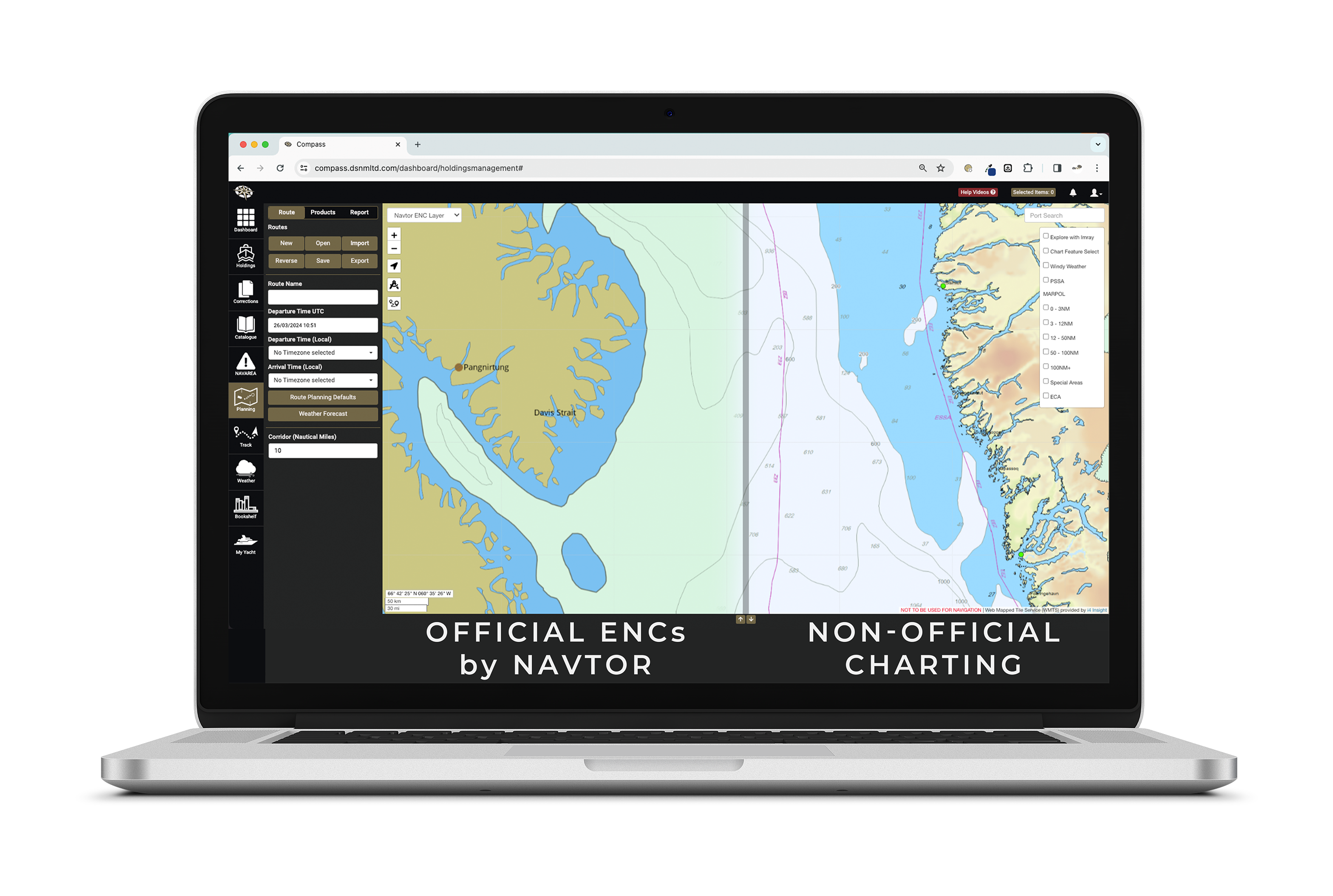
Compass (dsnm’s in-house navigation management software) now includes an ‘official ENCs online by Navtor’ layer to assist with the effective passage planning for any journey. This layer provides charting in a view as it would look within an ECDIS. The limitations of official charting can sometimes be the amount of detail when in more remote areas becomes inadequate. Therefore, Compass users can seamlessly switch to the ‘non-official charting’ layer provided by i4 Insight (formerly known as C-Map Professional). This layer offers additional, crowdsourced information that can be referenced when chartering these lesser-travelled waters.
Hardware
As Navigatx continues to supply and install hardware solutions for superyacht bridges they are building a reputation allowing them to develop integral partnerships with industry-leading tech companies and innovators. These companies are leading the way with their products, offering ground-breaking hardware for safe passage throughout the oceans and waterways. Established partnerships so far include FarSounder, Sea AI and WASSP.
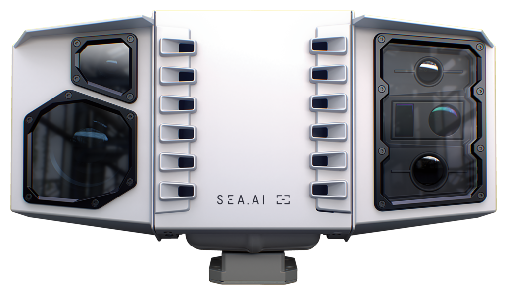
SEA.AI
Sea.AI’s Sentry technology utilises 360-degree surveillance and artificial intelligence to deliver situational awareness to the bridge team. The system is designed to survey the waters around the vessel and inform the crew of any potential hazards to prevent collisions. Sentry is also able to accurately assess objects in the water, from small items up to 700m (buoys, person in water), to slightly larger items (dinghy, rib, inflatable) up to 3,000m, to big objects (motor/sail yachts) up to 7,500m, all the way to large vessels on the horizon.
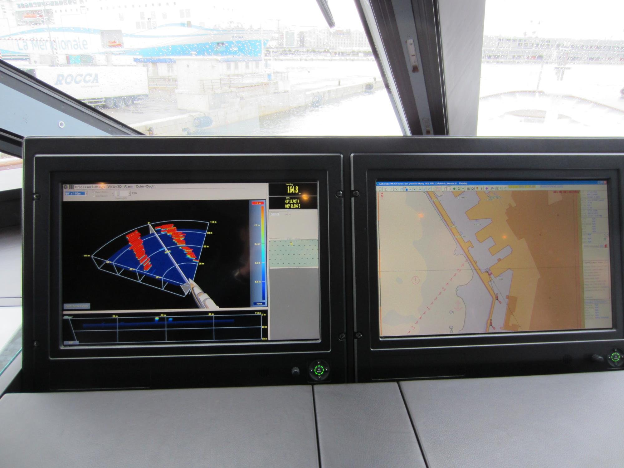
FarSounder Argos Series
Utilising forward-facing sonar, FarSounder has designed a system that maps the waterways up to 1,000 metres ahead of the vessel generating a detailed 3D image.
Employing 3-dimensional over 2-dimensional sonar, the system can provide substantial navigational data. The Argos Series sonar technology has a wide field of view and fast refresh rates with each ping to provide up-to-date information on the water depth ahead.
WASSP
The New Zealand-made WASSP system is installed on a tender, chase boat or support vessel and sent ahead to scan beneath the boat. Multiple beams scan in a 120-degree arc to remotely feedback accurate bathymetric data in a 3D image to the main vessel.
Information is transmitted wirelessly and quickly providing real-time data to ascertain a safe navigation passage for the mothership.
Further advice for others planning a passage to remote areas?
- Ensure your radar is within the service intervals, it will be vital in foggy/icy conditions.
- Research, research and research! The more homework and planning you can do prior to your trip, the better. Any information from other captains/officers who have cruised the areas before could be invaluable.
- Constant risk assessment and monitoring. The position of the sun matters to see unmarked obstructions.
- Collect as much local information as possible. ECDIS coverage is much better these days, but the local knowledge is priceless when visiting remote areas.
- All pilot books, etc, are available free from US and Canadian Hydrographic services.
- Ensure all crew involved in navigating are up to date with radar usage and make sure all watch standers are comfortable with full radar navigation, not just theoretical – it’s an art that is not practised enough.
- Make sure all crew understand the importance of remaining within areas of known safety, i.e. on a previously run track, and become consistent at always watching depth.
- Do not let ice navigation overrule safe water navigation – you can judge the depth of water by the size of grounded or moving bergs but it’s not recommended.
With thanks to the captains and crew who got in touch on LinkedIn
Find out more about dsnm’s Compass software
More on Navigatx